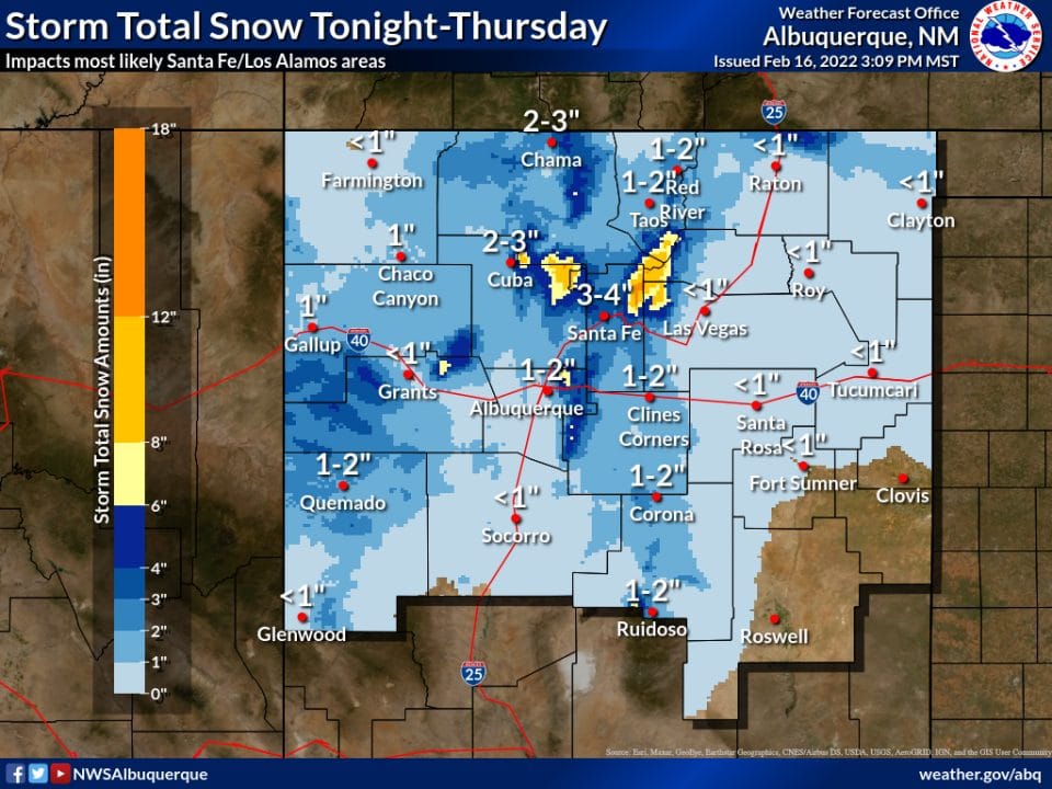
 The National Weather Service in Albuquerque predicts gusty winds and increasing chances for snow tonight over much of northern and central New Mexico. Temperatures early Thursday morning will be up to 15 degrees colder than on early Wednesday morning. Strong southwest winds this evening will give way to strong north winds late tonight and Thursday morning over the eastern plains. Courtesy/NWS Albuquerque
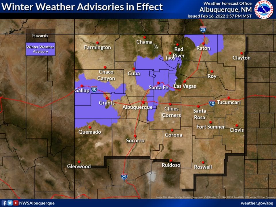 Winter weather advisories in effect. Courtesy/NWS Albuquerque
NWS News:
The National Weather Service in Albuquerque reports that winter weather will return to New Mexico this evening through Thursday morning with 3 areas of concern;
1. A band of snow will develop this evening across west central New Mexico across or just south of Gallup eastward to the Continental Divide. This may create difficult travel conditions on I-40.
2. Upslope flow will create an area of light to moderate snow this evening and overnight around Raton Pass.
3. A moderate band of snow is likely to develop from the Jemez Mountains south-southeastward to Santa Fe and along the East Mountains. This latter area is of greatest concern as the band of snow is likely to develop just before sunrise and will impact the Thursday morning commute. A back door cold front will also bring strong winds to eastern New Mexico.
Key Impacts Snow
Packed and icy roads. This includes I-40 from the Continental Divide westward to the Arizona border, as well as through and near Tijeras Canyon and I-25 near Raton Pass and Santa Fe.
Difficult driving conditions may impact commuters from the East Mountains to Albuquerque, Santa Fe to Albuquerque, or vice versa Thursday morning.
Strong cross winds are expected on east to west roadways across eastern New Mexico after midnight. Gusts between 40 and 50 mph likely.