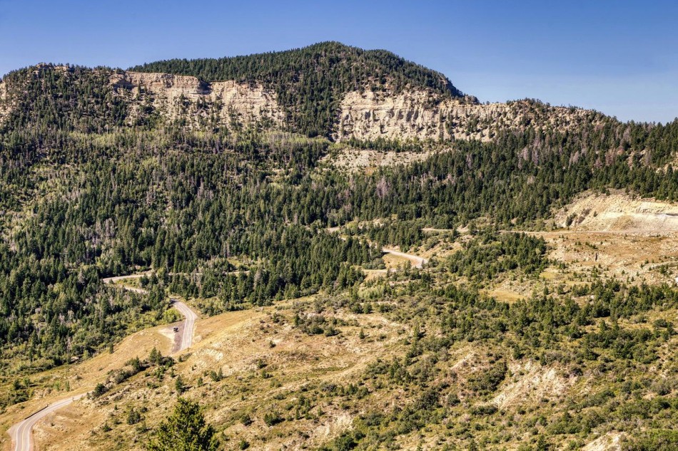
 Going Up: A view of the highway as it approaches Douglas Pass can be seen from a viewpoint on the Dinosaur Diamond National Scenic Byway. The highway climbs almost 4,000 feet in elevation from Loma, Colo. to Douglas Pass. Photo by Gary Warren/ladailypost.com
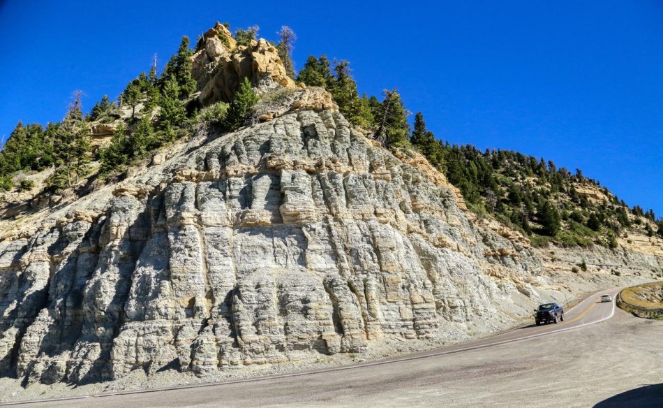 Douglas Pass: The hillside just around the bend from Douglas Pass reveals some interesting rock and soil bands as it rises in elevation. This area is very near the 8,268 foot pass. Photo by Gary Warren/ladailypost.com
By GARY WARREN
Photographer
Formerly of Los Alamos
Ralph Waldo Emerson’s famous quote “It’s not the destination it’s the journey” certainly applies to us as we travel around the country in our small RV. So often we set off on a trip with a specific destination as our goal but very often find that the journey to reach the destination is the real reward.
This occurred again on a recent trip to western Colorado. Our destination was the Dinosaur National Monument, which was the topic of last week’s Post From The Road. Indeed, that destination surpassed our expectations as we enjoyed and learned about the prehistoric creatures that roamed that area of Colorado millions of years ago.
However, our drive to and from the national monument was an added bonus to the day trip. The drive north from I-70 to the national monument was a portion of the Dinosaur Diamond National Scenic Byway. The byway is a circular route through Utah and western Colorado that features the dinosaurs but also man’s first recorded occupation of this territory, which was the Fremont and Ute Indian tribes.
In this Post we will feature the portion of the route that is within Colorado and the Dinosaur National Monument, which does cross the Utah border but for a short distance.
We exited I-70 at the tiny town of Loma, Colo. just a few miles west of Grand Junction, Colo. The drive to Dinosaur, Colo. just outside of the national monument is about 100 miles. I was aware that it crossed Douglas Pass in the mountains but I was not aware of the historic sites and features along the highway.
Since it would be impossible to see the sites along the byway and the national monument in a day trip, we chose to enjoy the scenic drive and cover the historic sites on another trip.
The drive from Loma, Colo. to the north is primarily farming and ranching country across the high desert. It’s when you reach the mountains and begin climbing to Douglas Pass that things get really interesting. The scenery transitions from high desert farming and scrub bushes to conifer covered mountains and each viewpoint along the way becomes more dramatic.
After gaining altitude for a few miles the highway takes a steeper climb before reaching Douglas Pass. The elevation at the pass is 8,268 feet, which is not that high of a pass in Colorado but when you look back at Loma, Colo. where the elevation is only 4,500 feet, that translates to a significant climb of almost 4,000 feet.
After crossing Douglas Pass the elevation drops into a valley known as Canyon Pintado, which leads travelers into the town of Rangely, Colo. It is in this portion of the drive where there are numerous historic sites and rock art can be found. The Fremont and Ute Indians were the original inhabitants of this region and are credited for the rock art and the early historical sites.
Today there are small farms and ranches through the valley. However the historic past of the region is being protected and preserved for future generations.
It is this portion of the Dinosaur Diamond National Scenic Byway that I want to return to and search for the rock art as well as nearby historic sites throughout this region of Colorado.
The journey to Dinosaur National Monument was the true bonus for this day trip. We have traveled all around this area but never really traveled or explored much of this remote area prior to this trip. We enjoy visiting western Colorado and will definitely be exploring this part of the state in future trips.
Editor’s note: Longtime Los Alamos photographer Gary Warren and his wife Marilyn are traveling around the country, and he shares his photographs, which appear in the “Posts from the Road” series published in the Sunday edition of the Los Alamos Daily Post.
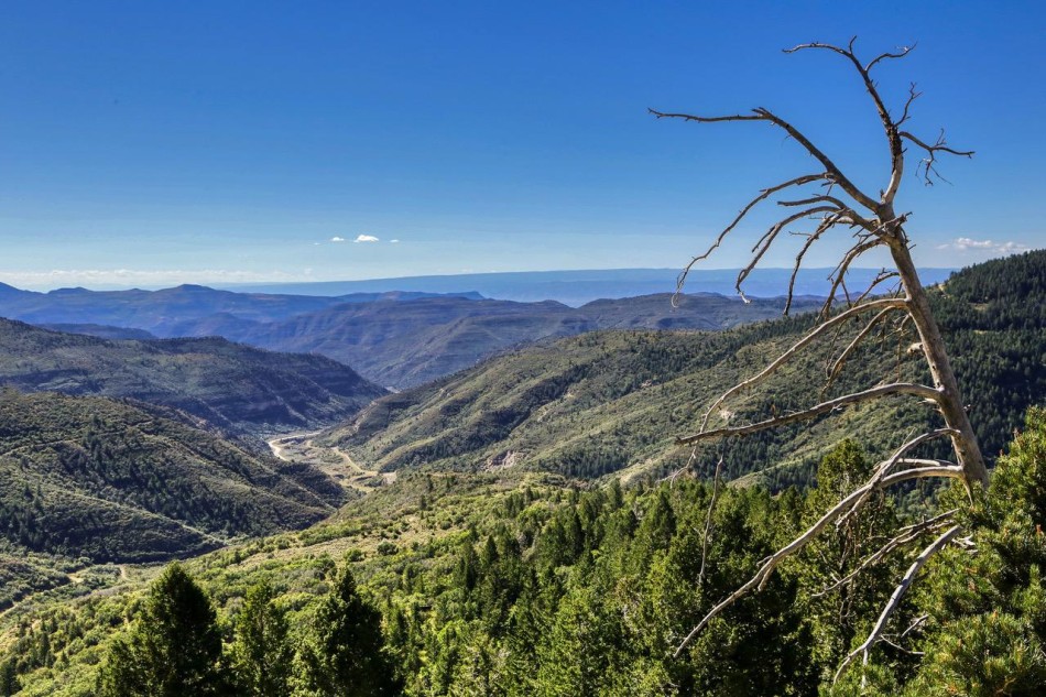 Overlook: Another overlook on the Dinosaur Diamond National Scenic Byway shows the path of the highway and beyond to the south of Douglas Pass. Photo by Gary Warren/ladailypost.com
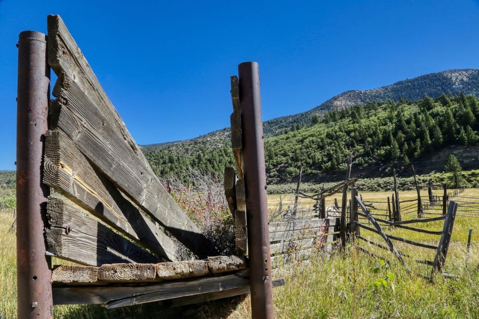 Round ’em Up: An old coral is seen in the Canyon Pintado, which runs north of Douglas Pass into the town of Rangely, Colo. This valley is home to small farms and ranches today but was home to the Fremont and Ute Indians for hundreds of years. Photo by Gary Warren/ladailypost.com
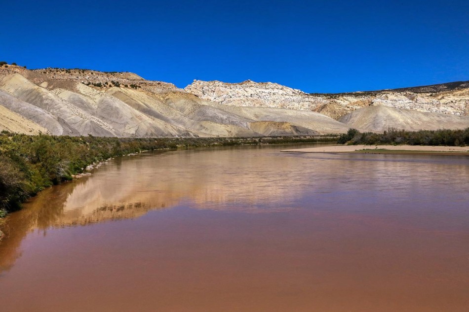 Green River: The Green River looks a little red in this view just on the southwest side of Dinosaur National Monument. The river flows through eastern Utah for miles before running into the Colorado River farther south. The Dinosaur Diamond National Scenic Byway wanders in a circular pattern through this portion of eastern Utah. Photo by Gary Warren/ladailypost.com