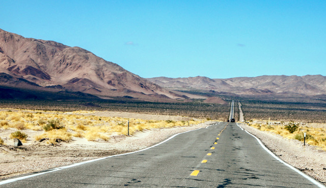
 Long Desert Highway: After exiting from I-15 at Baker, Calif. visitors still have 115 miles of desert highway to cover before arriving at Death Valley National Park Visitor Center in Furnace Creek. Views such as this are plentiful along the way. Photo by Gary Warren/ladailypost.com
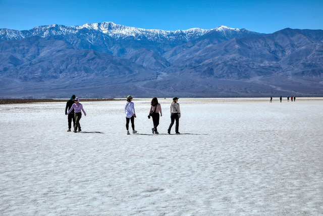 Salt Flats: Salt Flats cover hundreds of square miles in the floor of Death Valley National Park. Shown are visitors as they explore the salt flats at Badwater Basin in the national park. The flats look like snow from a distance but are hard as a rock to walk across. In the distance in the photo is Telescope Peak which is the highest point in the national park. The peak still had a covering of snow when we visited the park. Photo by Gary Warren/ladailypost.com
By GARY WARREN
Photographer
Formerly of Los Alamos
After a few days in San Diego and then touring the coastline north of the city it was time to take our travels in another direction. We did not want to travel through Los Angeles so we drove west from Oceanside, Calif. to I-15 and began to move northward.
We enjoyed driving through the Temecula Valley and with beautiful inland mountains and valleys of agriculture before passing through the city of Temecula. A short distance north of Temecula we chose to take I-215 north for a stretch before rejoining I-15 shortly before crossing Cajon Pass into the Southern California desert.
Our destination was Death Valley National Park but we chose to stop near Barstow later that afternoon. The next day we were on our way to the largest national park in the lower 48 states. We exited I-15 in Baker, Calif. but we still had almost 115 miles before reaching the Death Valley Visitor Center in Furnace Creek.
Death Valley is huge. It stretches across the Mojave Desert for miles and miles. The park is 3.4 million acres in size, which means visitors must pick and choose which area of the park they would like to visit unless they have weeks to explore the park!
One of the popular stops for visitors in the park is Badwater Basin. While the area is interesting and fun to visit it is not the most scenic stop. Badwater Basin is known for its altitude or lack thereof. This is the lowest elevation of anywhere else in North America at 282 feet below sea level.
This was our first visit to Death Valley National Park so Badwater Basin was a must for us.
Much of the huge valley in the park is covered with salt flats. The salt flats look like snow is covering the valley floor where the salt flats exists. However upon stepping out onto the flats, the surface is crusty but very solid and hard to the touch. Besides the low elevation, Badwater Basin is one of the areas of the salt flats that is easily accessible to walk on and explore.
While the flats are as “hard as a rock” they are constantly moving and reshaping. The surface is course and gritty and feels similar to sandy soil. The decks near the parking lot and walkways in the area look like everyone has just exited a white sand beach and left a few remnants along the way. Our van still has signs of the crusty sand even after a few cleanings. The sand that gathered on our running boards by the front doors on the van have since crystallized and will require a brush to get rid of it.
As mentioned above the salt flats are always changing. As wind sweeps across the valley the salt crystals move about, change in size and create wildly diverse forms. When we were at the park earlier in March there had been no rain for weeks. Blowing dust collects on the crystallized forms making them look dirty. However when a rain occurs the forms will be washed clean and will be as white as snow.
A short drive north of Badwater Basin is a stop called Devil’s Golf Course. Upon stopping and walking out among the formations one can get an up close view of the salt formations. Most of the formations range from a few inches in size to a couple of feet in size. We enjoyed walking among the area and I was amused at the name given to the stop; Devil’s Golf Course.
Death Valley National Park is not just huge in size. The park is home a variety of plants and animals as the desert elevation varies from 282 feet below sea level to elevations over 11,000 feet in the mountains. The landscape is just as varied as one goes from salt flats to rocky mineral filled mountains to alpine forests mountain tops.
This was our first visit to Death Valley National Park and we just enjoyed some of the highlights of the park. We will be back but even then it will be difficult to cover all of the areas I want to see and photograph because the place is so large. Time will tell but we will be back for more visits.
Editor’s note: Longtime Los Alamos photographer Gary Warren and his wife Marilyn are traveling around the country, and he shares his photographs, which appear in the “Posts from the Road” series published in the Sunday edition of the Los Alamos Daily Post.
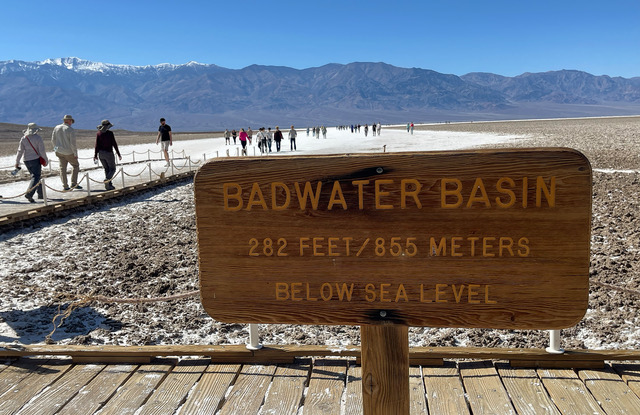 Badwater Basin: Badwater Basin is a must stop especially for first time visitors to Death Valley. The elevation at Badwater Basin is 282 feet below sea level. The temperatures in March when we visited were very nice, most visitors wore long sleeve tops and many had jackets. However, in the summer it is scorching hot reaching 130 degrees Fahrenheit in July 2021. Photo by Gary Warren/ladailypost.com
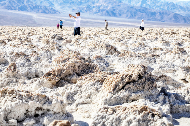 Devil’s Golf Course: Visitors (or golfers as I like to call them) explore the landscape at the Devil’s Golf Course in Death Valley National Park. The salt formations range in size from a few inches to a couple of feet. Photo by Gary Warren/ladailypost.com
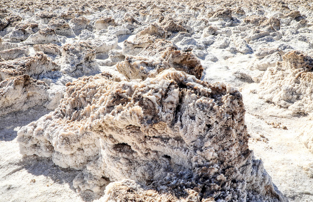 Salt Formations: A close view of the salt formations at the Devil’s Golf Course at Death Valley shows how wind constantly changes the look of the landscape. The crystallized salt looks brownish from dust when there has been no rain but following a rain the formations will be as white as snow. Photo by Gary Warren/ladailypost.com
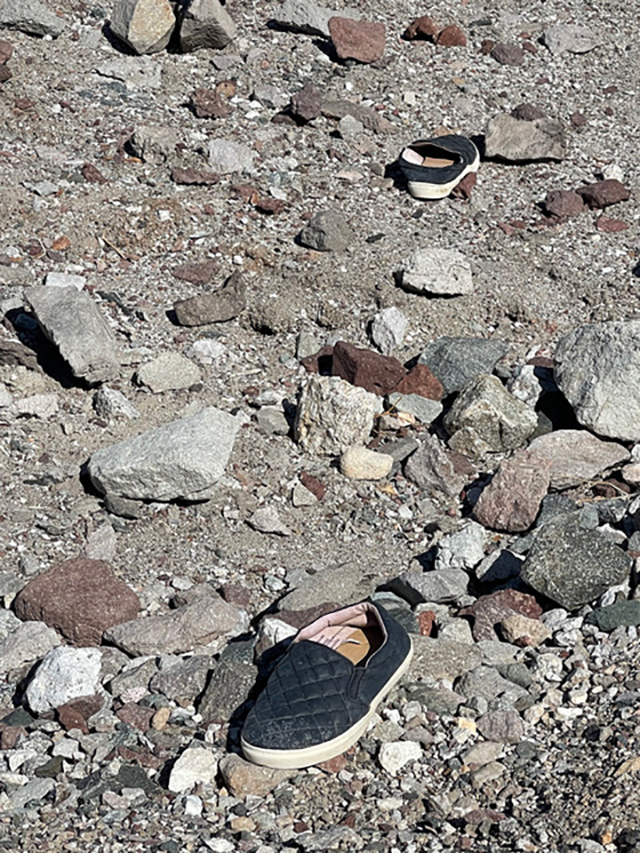 Coming or Going: A person just walked out of their shoes and left them lying among the rocks at Badwater Basin. There’s no telling whether the person was coming or going. Photo by Gary Warren/ladailypost.com