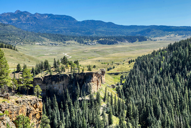
 Sally Overlook View: A view from Sally Overlook in the San Juan Mountains north of Pagosa Springs, Colo. of the expansive valley to the east. The overlook is a pie shaped ledge that provides views in several directions of the valley and mountains in the area. Photo by Gary Warren/ladailypost.com
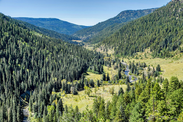 Piedra River Valley: Looking toward the southwest from Sally Overlook gives viewers a great view of the Piedra River flowing to the southwest through the Piedra River Valley and meadows. The elevation at the overlook is just over 8,400 feet and the elevation along the river is about 7,500 feet, a 900 foot difference in elevation. Photo by Gary Warren/ladailypost.com
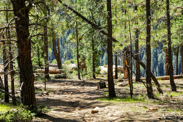 Sally Overlook Ahead: The hike to the Sally Overlook leads hikers through a conifer forest. When the trail nears the overlook, hikers can see the light shining through the trees from the open space beyond meaning the views are near. Photo by Gary Warren/ladailypost.com
By GARY WARREN
Photographer
Formerly of Los Alamos
We recently met with friends from Los Alamos for a campout in the San Juan Mountains in southwestern Colorado. We camped in the Williams Creek Campground near Williams Creek Reservoir, which is about 25 miles north of Pagosa Springs, Colo. and surrounded by mountains in every direction.
We thoroughly enjoyed exploring the area in the San Juan Mountains during the day and gathering around the camp fire at night. The skies were clear with a few puffy white cumulus clouds during the day and were filled with stars and cool mountain air every evening. Our camp sites were located steps from Williams Creek and about a half mile south of Williams Creek Reservoir.
This area of Colorado offers unlimited outdoor recreation especially in the summer and fall months. Many Forest Service Roads lead to nooks and crannies throughout the forest, there are miles of hiking trails, and the rivers and lakes offer great fishing and other water sports.
We enjoyed exploring the area’s wide open meadows with cattle grazing on the lush grasses, hiking to waterfalls, and gazing at the majestic mountain peaks as we traveled about each day.
One hike stands above other activities, which led to Sally Overlook. From the trailhead parking lot on FS Road 631, the trail leads across a meadow to the south. Within 200 yards, the trail splits, one trail takes a downhill route toward the Piedra River and the other trail goes uphill toward to the conifer forest. We took the uphill route toward Sally Overlook.
Little did we know that the trail to Sally Overlook is known as Piedra Ice Fissures Trail or Ice Cave Ridge Trail. However, about three miles into the hike we discovered various sizes of rifts or fissures in the earth’s surface. Coming across these fissures on a hike was quite a surprise. We explored around and noticed other smaller rifts as well. The larger fissures are more than 100 feet long, up to about eight feet wide and the deepest fissure was about 30 feet deep. Deep enough that we could not see bottom in some places. We made this hike in early September so we saw thee Piedra Ice Fissures in their dry, summer state.
We left the fissures and continued our trek toward the Sally Overlook. It turned out that we were not that far from the view that we hoped to find. As we approached the overlook we could see open the space of the canyon as we walked through the last trees on the trail. Once we reached the overlook we walked around and gazed over the rim at the steep sheer drop off and the river in the canyon below.
The Sally Overlook forms a point at the end of the ridge making the overlook a pie shaped viewpoint. This allowed us to walk around and enjoy the view from different directions. To the southwest we viewed the Piedra River as it made its way through the canyon and surrounding meadows. We were able to see hikers who took the lower trail route near the beginning of the hike, which led to the river. To the east we viewed the geological uplift in the earth’s surface that formed the canyon and the expansive valley beyond where cattle grazed and hay was being harvested and baled by farmers. The view was spectacular in every direction.
After about an hour spent taking in the views and photographing the canyon, valleys, and mountains that surround the Sally Overlook we began our hike out on the same route that we hiked in on. We thoroughly enjoyed our time at the overlook and our time together on the trail but it was time to go back to the truck where lunch was waiting.
I have tried to find the origin of the viewpoint’s name of Sally Overlook but I have not been able to find anything. I will continue to know it as the Sally Overlook on the Piedra Ice Fissures Trail!
Editor’s note: Longtime Los Alamos photographer Gary Warren and his wife Marilyn are traveling around the country, and he shares his photographs, which appear in the “Posts from the Road” series published in the Sunday edition of the Los Alamos Daily Post.
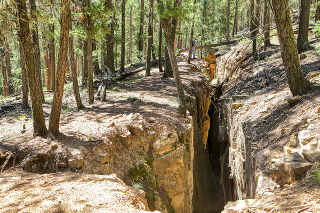 Fissures: The name of the trail that leads to Sally Overlook is named the Piedra Ice Fissures Trail or Ice Cave Ridge Trail. About three miles into the hike fissures begin to appear near the trail. Shown is a fissure which is over 100 feet long and about 30 feet deep. The width of the opening at the surface varies from about 3 feet to eight feet. For scale, look for the other hiker (upper center in photo) as he peers into the fissure from ground level. Photo by Gary Warren/ladailypost.com
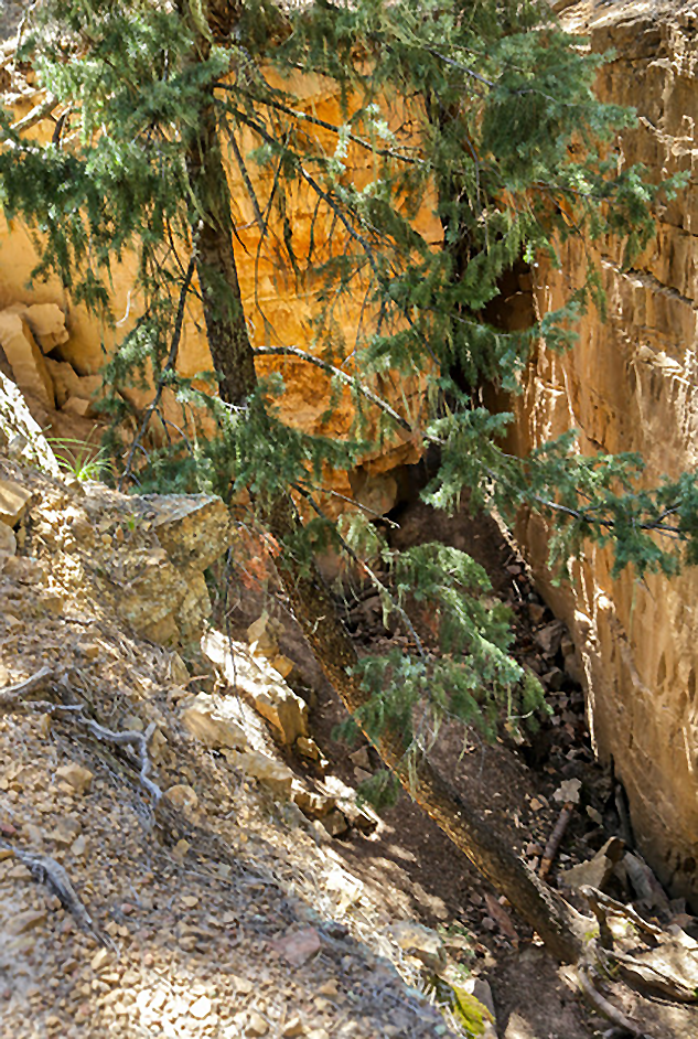 Tree in Fissure: A tall tree is rooted in the bottom of a fissure and curves as it extends several feet above the ground level. The roots can be seen in the bottom right of the photo and the tree continues out of the frame in the upper left portion of the photo. Photo by Gary Warren/ladailypost.com
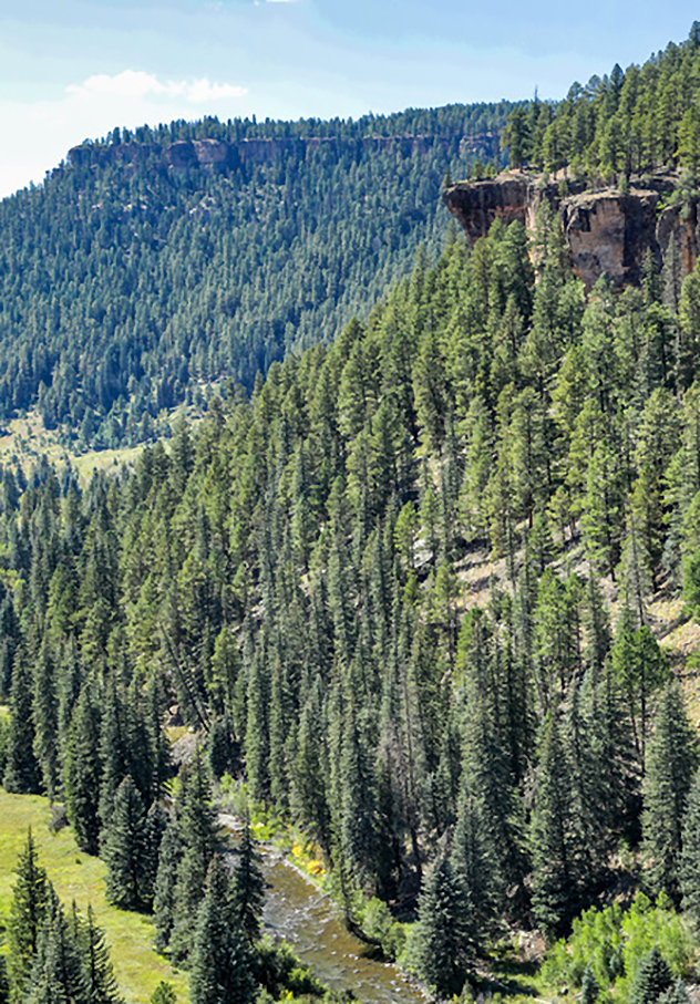 View of Sally Overlook: A nearby ledge to the east gives viewers a view of the Sally Overlook and a portion of the Piedra River below. The overlook is the darker triangular area in the upper portion of the photo and the river flows in the valley about 900 feet below. Photo by Gary Warren/ladailypost.com
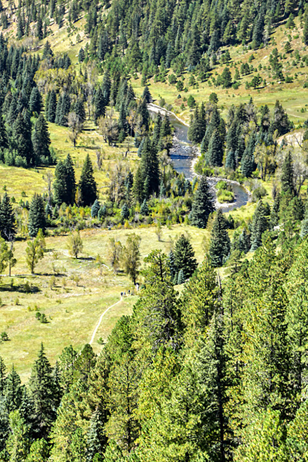 Piedra River and Trail: The Sally Overlook provides a nice view of the Piedra River and the Piedra River Trail in the valley floor. A group of hikers can be seen on the trail as it crosses a meadow in the lower center of the photo. The Piedra River eventually joins the San Juan River near Navajo Lake. The San Juan River later joins the Rio Grande River in southern Colorado before the river begins its long run through New Mexico. Photo by Gary Warren/ladailypost.com
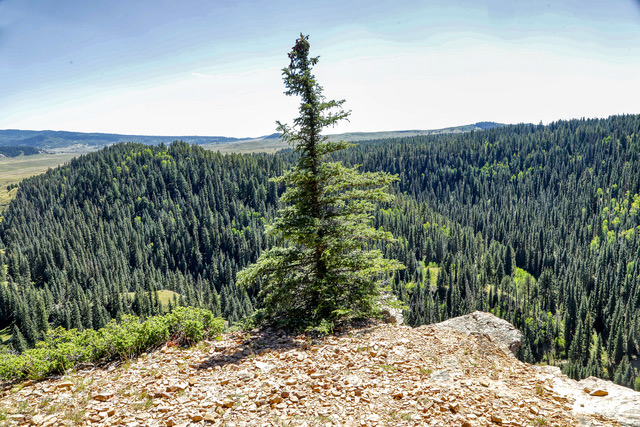 Resilience: A very resilient tree grows out of the rocks on a point at the Sally Overlook. The tree shows wear and tear from the winds and other weather elements but stands tall on the point of the overlook. Photo by Gary Warren/ladailypost.com