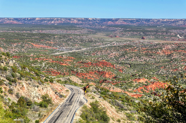
 Highway and Canyon View: Texas Highway 207 weaves its way through the rugged landscape of Palo Duro Canyon in the Texas Panhandle. This route allows travelers a view of the mid-section of the canyon which is privately owned ranch land. The canyon stretches for more than 100 miles and varies in width from six to 20 miles wide. The depth of Palo Duro Canyon varies but is about 800-1,000 feet deep in most areas. Photo by Gary Warren/ladailypost.com
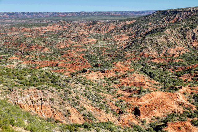 Palo Duro Canyon: A rest area and view point on the southern side of Palo Duro Canyon gives viewers a nice wide view of the canyon and the north rim in the distance. There are plaques at the rest area and in the canyon which give visitors the history of the area and the need for a pathway through the canyon. Photo by Gary Warren/ladailypost.com
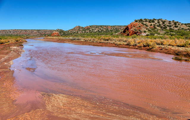 Red River: The Prairie Dog Town Fork of the Red River flows through Palo Duro Canyon. The river has carved the canyon out of the plains of the Texas Panhandle over thousands of years. Highway 207 passes over the river giving travelers a glimpse of the red waters of the river and the surrounding red sandy soil in the area. Photo by Gary Warren/ladailypost.com
By GARY WARREN
Photographer
Formerly of Los Alamos
The Texas Panhandle is made up of vast wide plains, which spread for miles in every direction. Travelers will encounter cattle grazing, hay fields full of large round bales harvested in the late fall season, cotton fields scattered about and big skies hanging over the entire region of the state.
However, an area of the region beginning east of Canyon, Texas and continuing for well over 100 miles toward the southeast, the plains give way as the land mass sinks hundreds of feet below the surface elevation into the second largest canyon in the United States. This is Palo Duro Canyon.
In a region of the state where few trees are seen on the flat surface of the plains, as one approaches Palo Duro Canyon the open plains are replaced with oak and mesquite trees, cacti and other foliage of the high desert.
While the canyon is not as dramatic and deep as the Grand Canyon, Palo Duro Canyon is beautiful and rugged in its own ways. The upper end of the canyon is home to the very popular Palo Duro Canyon State Park. On the far southern end of the canyon sits Caprock Canyon State Park. Both parks show off the majesty and beauty of the red rock canyon but that leaves a large section of property in the mid-section of Palo Duro Canyon which is privately owned ranch land.
Texas Highway 207 is the pathway that allows the public to drive through the middle section of Palo Duro Canyon. Highway 207 is not a heavily traveled highway today but it began as an important route for early settlers to pass from the lower territory of the panhandle to areas north of the rugged canyon. Before the route was established travelers were forced to go around the canyon which added significant distance to the trip.
We love traveling this highly unrecognized back road when traveling through the panhandle during our trips from Colorado to Texas. The time actually spent in Palo Duro Canyon is short but the spectacular scenery makes the drive very enjoyable.
There are only a few safe stopping points through the canyon on Highway 207 but those stops allow for beautiful views of the middle section of Palo Duro Canyon. Drivers will enjoy multi-color layers of rock and canyon walls as they pass through the area. On the southern side of the canyon a rest stop and viewing area gives travelers spectacular sweeping views of this section of the canyon.
In the lowest section of the canyon road a bridge passes over the Prairie Dog Town Fork of the Red River. This shallow body of water is credited with carving Palo Duro Canyon over thousands of years. Today the river meanders through the canyon showing off the red waters surrounded by red rocks and red sandy soil along the shores of the river.
There are multiple historical plaques in the canyon and at the rest stop which give visitors a history of the road and Palo Duro Canyon.
This highway is a hidden gem which leads travelers on a direct north-south path through this region of the panhandle. When traveling the area, a little extra time to drive Highway 207 will give one a good view of Palo Duro Canyon and the high plains surrounding the canyon in the Texas Panhandle.
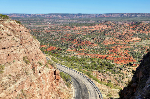 Canyon Walls: As Highway 207 descends into the canyon on each side travelers enjoy the multi-colored landscape of the canyon. The Highway drops from the panhandle plains which are dotted with ranch lands and fields of cotton into the canyon which features trees, cacti, and other plants of the high desert. Photo by Gary Warren/ladailypost.com
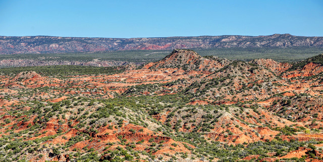 Rugged Terrain: A closer view of Palo Duro Canyon from the overlook on the south side of the canyon gives visitors an idea of the canyon landscape which make up this unusual canyon in the middle of the plains of the Texas Panhandle. Photo by Gary Warren/ladailypost.com
Editor’s note: Longtime Los Alamos photographer Gary Warren and his wife Marilyn are traveling around the country, and he shares his photographs, which appear in the “Posts from the Road” series published in the Sunday edition of the Los Alamos Daily Post.