Travel

Cone Zone For Week Of July 15, 2024

CONE ZONE:

Public Works Projects: 

Los Alamos County Public Works’ staff manages the projects listed in this section through contractors.

For more information, email lacpw@lacnm.us, call 505.662.8150, or visit the “County Projects” link and select “Public Works” at https://lacnm.com/pw-projects

Please slow down and use caution within the construction work zones.

Note that the information below is based on a schedule provided by the contractors and may change due to weather or other delays. 

DP Road Phase II Reconstruction Project Update

TLC Plumbing & Utility Read More
Posts From The Road: Sawtooth National Recreation Area

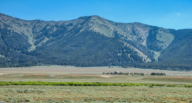
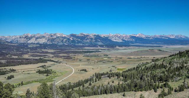
Sawtooth Mountain Range: A view of a portion of the Sawtooth Valley and the Sawtooth Mountain Range are seen from the Bethine and Frank Church Overlook Viewpoint where visitors get their first panoramic view of the Sawtooth Mountains and the Sawtooth Valley. The overlook is located near the Galena Summit on the Sawtooth Scenic Byway. The headwaters of the Salmon River are near this viewpoint but it is a small stream. The river increases in size by the time it reaches Stanley, Idaho, just a few miles farther north. Photo by Gary Warren/ladailypost.com

Ranch and Boulder Mountains: While driving Read More

Update: Canyon Road Reconstruction Project Warranty Work

COUNTY News:

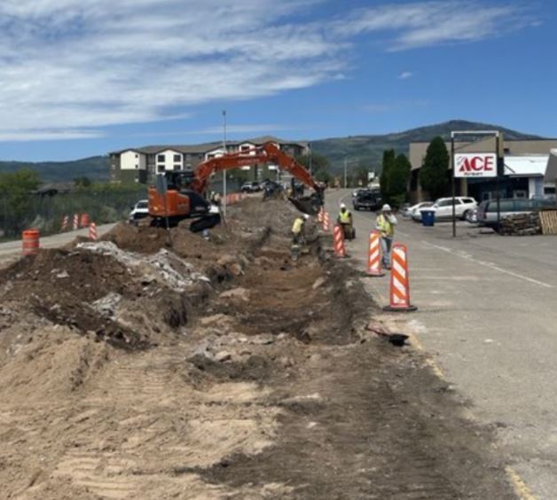
TLC Plumbing and Utility will complete the final portion of warranty work on  July 15, for the Canyon Road Reconstruction project.

The warranty work will repair two water valve concrete collars that have become loose and pose a safety issue. Traffic cones will be placed over the concrete collars to allow for the concrete to cure. The traffic cones will be removed by the end of the day July 19.

Until cones are removed, the western driveway of the Aquatic Center and the driveway to Canyon Village Apartments will be restricted to right-in and right-out traffic movements. Vehicles exiting Read More

In-Person Car Seat Inspection In Los Alamos Saturday

First Born Program News:

The First Born Program of Los Alamos is hosting the New Mexico Department of Transportation Traffic Safety Division (NMDOT TSD) and Safer New Mexico Now for an in-person Car Seat Inspection Clinic.

The clinic is 10 a.m. to noon Saturday, July 13, at the Betty Ehart Senior Activity Center, 1101 Bathtub Row in the lower parking lot.

This free educational clinic provides parents and caregivers instruction on the proper selection, installation and use of their car seats from nationally certified Child Passenger Safety Technicians (CPSTs).

At the clinic, CPSTs will spend Read More

Atomic City Transit Detours Friday July 12: Routes 1, 4C, 6C

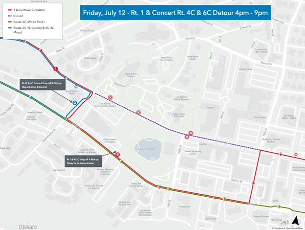
Map indicating bus stop closures and stops on Trinity and Oppenheimer that can be utilized. Courtesy/LAC

COUNTY News:

Due to a temporary closure on a section of Central Avenue, Atomic City Transit Routes 1 and concert service 4C and 6C will be detoured 4-9 p.m. Friday, July 12.

Route 1 will detour inbound to the transit center down Central Avenue left on 15th Street, right on Trinity Drive, right on Oppenheimer Drive and back onto Central Avenue.

Whtie Rock Route 2C will come up the Main Hill (N.M. 502) into Los Alamos and drop off/pick up on Trinity Drive near the Justice Center and continue to White Read More

NM State Police Issue Over 2,700 Traffic Citations & Arrest 37 Drunk Drivers During Independence Day C.A.R.E. Operation

NMSP News:

During the 2024 Independence Day holiday, the New Mexico State Police (NMSP) participated in the Combined Accident Reduction Effort (C.A.R.E.) operation across all roadways within the state.

The goal of the traffic initiative is to increase motorist safety and reduce the number of crashes through a strong law enforcement presence.

Because of the increased volume of traffic during the holiday, NMSP increased its patrol presence during this initiative on roadways throughout all State Police districts on the busiest travel days of the Independence Day weekend, specifically Read More

NNSA To Conduct Helicopter Aerial Radiation Assessment Flights Over Milwaukee Ahead Of GOP National Convention

Twin-engine Bell 412. Courtesy/NNSA

DOE/NNSA  News:

WASHINGTON, D.C. – The U.S. Department of Energy’s National Nuclear Security Administration (DOE/NNSA) will conduct low-altitude helicopter flights over downtown Milwaukee, Wisc., Tuesday, July 9 through Thursday, July 11, in support of the 2024 Republican National Convention.

NNSA’s Nuclear Emergency Support Team (NEST) aircraft will measure expected background radiation as part of standard public health and safety preparations.

The public may see a twin-engine Bell 412 helicopter, which is equipped with radiation-sensing Read More

Posts From The Road: Beartooth Highway

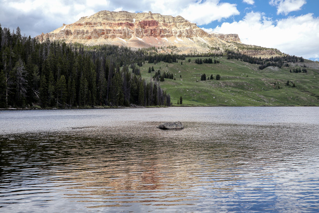
Beartooth Lake: Ripples from the wind on Beartooth Lake interrupt the reflection of Beartooth Butte, which sits a short distance from the lake. The butte rises 1,500 feet above the lake to an elevation of 10,518 feet above sea level. Photo by Gary Warren/ladailypost.com

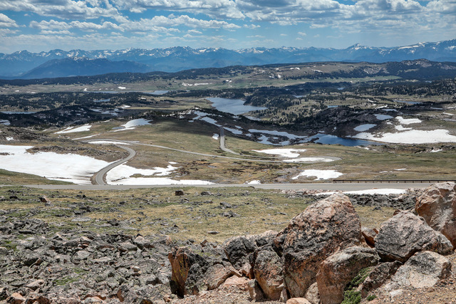
Lakes and Vistas: A viewpoint on the Beartooth Highway reveals stunning alpine vistas including several of the 950 plus lakes in the Beartooth Mountains. Also shown are a few of the switchbacks in the highway as it ascends in elevation. In the distance are the Absaroka Mountains. Photo by Gary Warren/ladailypost.com

By GARY Read More

Cone Zone: Week Of July 8, 2024

COUNTY News:

Public Works Projects:

Los Alamos County Public Works Department staff manages the projects listed in this section through contractors.

For more information, email lacpw@lacnm.us, call 505.662.8150, or visit the “County Projects” link and select “Public Works” at https://lacnm.com/pw-projects.

Please slow down and use caution within the construction work zones. Please note the information below is based on a schedule provided by the contractors and may change due to weather or other delays. 

DP Road Phase II Reconstruction Project Update

Courtesy/LAC

TLC Plumbing & Read More

Posts From The Road: Chief Joseph Scenic Highway

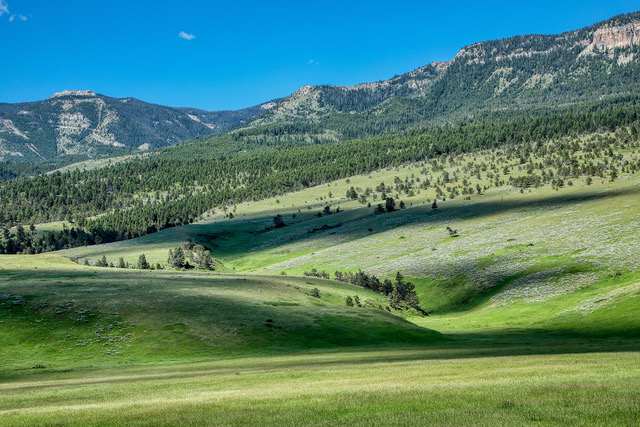
Peaks and Valleys: When traveling the Chief Joseph Scenic Highway from the southern end out of Cody, Wyo. the hills and valley landscapes are more gentle. Just a few miles farther up the scenic drive into the mountains the views become much more rugged. Photo by Gary Warren/ladailypost.com 

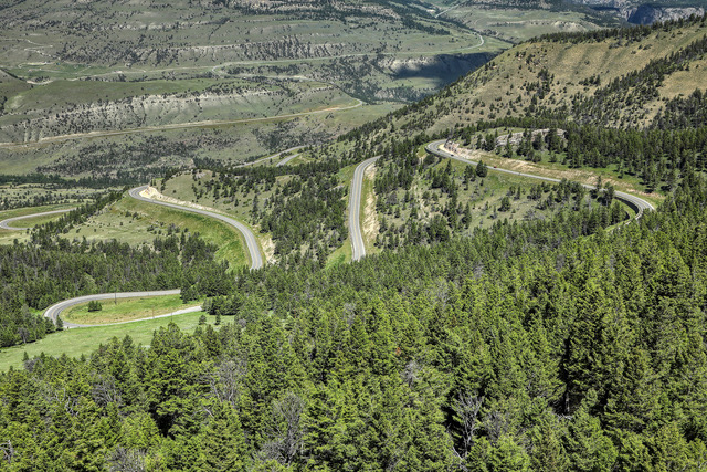
View from the Pass: Dead Indian Pass is the highest point on the Chief Joseph Scenic Highway in Wyoming. Shown is a view of the road as it twists and turns as it drops in elevation when leaving the pass to the north. The pass is 8,071 feet in elevation and offers spectacular views of the Absaroka Mountains and beyond Read More